Sunday, May 30, 2010

Somewhere in Montana

Just a quick update that we've made it to somewhere in Montana about
40 miles outside Great Falls. As soon as the tire stores open we will
be in search of a replacement for the blow out on the trailer earlier
today and some more work on the trailer at the dealership. Thank
goodness for small drop in RV sites so we are all safe & sound.

Sent from my iPhone

Sunday, May 23, 2010

May 22, 2010 - Moab & Canyonlands National Park - Needles District (Utah)

We got a leisurely start on Saturday and left the RV about 10am to drive the 74 miles Southwest to the Needles District of Canyonlands National Park.  It took us about an hour and a half to get there.  On our way there, we passed the Newspaper Rock State Historical Monument (click on the name for more info).  It was an amazing collection of petroglyphs just right off the road into Canyonlands' Needles District.

Don't forget you can click on this photo (or any other photo) to get a larger view of it to actually read the sign.
Would you look at how many toes they had back then???  ha ha!!!

We then continued the drive into the Needles District at Canyonlands National Park.  The park itself is divided into three districts, Island in the Sky (all of our previous visits), Needles (today's visit) and the Maze (no roads available into this district so we won't see it this trip) by the Colorado and Green rivers.  We stopped by the visitors center for a short film and then on to have a picnic lunch at the picnic area near Pothole Point.  After lunch, we drove a short distance to the Slickrock Trail and hiked the 2.4 mile loop all over slickrock.  It took us to several viewpoints and was a really neat trail with it constantly going up and down over the slickrock.  I think I should mention that it has been incredibly windy here with winds gusting to around 50 mph.  We were glad the wind was out our faces instead of our backs as we viewed out over the overlooks!  We were still struggling to stand upright at times though...


We then drove back along the main park road to do the short .6 mile walk around Pothole Point.  Needless to say, we haven't had any rain since we've been here so this hike is better left for when there is actually water in the potholes.  Off we went to explore the .6 mile Cave Spring trail.  This one was really neat due to the cowboy artifacts left behind in one of the alcoves.  A couple of small ladders and we climbed to the top of the hill for a great 360' view of the area.  Our last stop in the park was to do a very short .3 mile walk to the Roadside Ruin.  It is a very intact grainary located in a cliff.  Its estimated date is again 1200 AD. 

We made the 1.5 hour trip back to Moab and had a nice quiet dinner at the RV.

May 21, 2010 - Moab, Utah

We spent Friday doing lots of errands and enjoying being back in civilization.  We started out by trying to get the truck some TLC.  As we are just about to begin our BIG drive up North, we decided that he needed some maintenance work.  He got his oil changed and an appointment to have his tires rotated and brakes checked for Saturday.  After the truck was properly fed (lubed ???) we headed out for our own breakfast at the Moab Diner.  We then strolled around Moab's downtown area and did some shopping at the gear store and the grocery store.

We spent the afternoon at the Arches National Park Visitor Center and then headed back to the RV for rest and relaxation.  Sometimes its kind of nice to have a relaxing day without doing much sightseeing. 

Friday, May 21, 2010

May 20, 2010 - Moab & Canyonlands National Park (Utah)

We started the day out with a relaxing morning in the RV (no sunrise photos for Matt this morning).  Matt spent the time by doing some more RV repairs and some touch up paint on the trailer tongue.  It is amazing that being down in Padre in the salt air for only 1 month has caused so much rust to magically appear.  I spent the morning hiding from all the cottonwood stuff that is floating and making it look like snow on the ground, ugh...  I hate allergies.  After a quick lunch at Wendy's (it is good to be back in a town with fast food!).

We headed back the 30+ miles to Canyonlands National Park for the day and evening. It seems that today is the day for exploring ancient dwellings.  We started out with a 2.1 mile mile out to the Aztec Butte.  It was a 500 foot climb to the top of the steep butte.  The climb up the butte was all on slickrock and on at least one occasion, Matt had to take my pack so I could make it up the steep section.  It was well worth the climb to see 3 ancient grainaries that are estimated to be construction in 1200 AD.  I'll have photos of it later on.

The second hike was to a site that is not normally on the map.  It is considered an archaeological site that is only available if you ask for it by name.  The hike is not well marked so we had to constantly watch the trail markers when they existed.  The first part of the hike was fairly easy, but to actually get into the site was a bit of challenge.  We had to hike down about a 1000 feet and then back up through boulders and loose rock to the alcove hanging in the middle of the sheer rock. The hike definitely made us think of how hearty the Ancient Puebloans must have been.  However, the site and solitude were well worth it.

What a peaceful, quiet place - The size and grandeur of the alcove seems at home with the simplicity of the structure - What a perfect balance

We ended the evening by doing a sunset shot of Green River Overlook and eating our picnic dinner on a site near the overlook. 

Thursday, May 20, 2010

May 19, 2010 - Dead Horse Point State Park & Moab (Utah)

Today was our last day in Dead Horse Point State Park and we have to be ready to leave by noon.  Matt started out by doing his normal sunrise shoot.


We spent the morning hiking around to all of the overlook areas in the park.  We started out at our campground and hiked the 4+ miles down to the neck and then back up to the Visitors Center and then back to our campground. 
Matt enjoying the view of the Shafer Canyon overlook.
We came back to the RV and in 30 minutes had it all packed up and ready to do the 32 mile drive into Moab.  We got settled into our camground, Slickrock.  We barely have enough room to slide out as the sites are so narrow.  We are starting to understand the difference in the ratings in all our campground books and we see why this one is rated lower than the ones we have been staying at.  It could be really nice as there are lots of cottonwood trees all over, but they tried to squeeze in too many sites.  I doubt we will return to this campground in the future.

After getting settled in, we decided to visit the metropolis of Moab.  We're not sure if its just really busy here or if we are just used to the quiet of the parks, but its been a bit overwhelming!!  Lots of RV's, Jeeps, bikes, people, etc.  We visited several bike stores and a couple of gear stores.  I'm not the proud owner of a new smaller backpack that should hopefully help me out hiking a bit.  Matt found a new attachment for his pack that he had been looking for also.

We enjoyed a great burger dinner at the Moab Brewery where we both enjoyed some of their homemade root bear.  Back to the RV for a peaceful evening and a few catch up items.

Wednesday, May 19, 2010

May 18, 2010 - Dead Horse Point State Park & Canyonlands National Park (Utah)

For those of you who are wondering just where exactly we are, here is a map of the area and we are in Dead Horse Point (red square) right now and will go to Moab after.

Matt started out his day with a sunrise shoot of Dead Horse Point and the Colorado river below.  The weather is chilly with our high only reaching into the high 50's and partly cloudy.

What a beautiful view at sunrise.  
I have to look at the photos as I'm very unlikely to make the actual shoot.  
Sunset is more my style or as Matt tells his dad, that I need training to get up and fix his coffee at 5 in the morning before he goes...  Hope he's not holding his breath...

And another beautiful view...


Since Dead Horse Point State Park is right next to Canyonlands National Park, we decided to drive over there for the day.  We hiked the 1/2 mile to Mesa Arch and took several photos there.  We continued and drove all through the park stopping at all the major viewpoints along the way.  We tried to have a picnic at one of the overview points, but it was too chilly so we ended up eating our picnic lunch in the front seat of the truck so we were out of the cold wind.

Here we are in front of Mesa Arch.  
What a gorgeous view (and huge drop as I happened to look over the edge).

Another view of the dramatic scenery. 

As soon as we got back to the RV, it started raining and thundering so we decided that the warmest (and safest) thing to do is to hang out until the weather improves.  It did improve in time for us to go for a sunset shot at Dead Horse Point.

Sunset over the Colorado River

Tuesday, May 18, 2010

May 17, 2010 - Dead Horse Point State Park (Utah)

We left Bryce Canyon about 9am to start our drive to Dead Horse Point State Park near Moab, Utah.  According to map quest, the drive was to take about 4.5 hours however, we have at least one stop along the way planned.  We have been without a real grocery store since we left Padre several weeks ago and are in need of restocking.  A great iPhone App for Wal-Mart very clearly pointed one out along our route (what would we do without our iPhone and Wal-Mart???).  We stopped in Richfield, Utah for a Wal-Mart stock up and for lunch.


We made it into the campground in the park around 4pm.  Its a very small campground with only 21 spots in it and I was lucky enough to find tonight and tomorrow night open when I was looking about a month ago.  The roads in the campground are very narrow and our spot was the first one that we came to when we entered the campground.  I think Matt's exact comment was "How the Hell am I supposed to back this thing in there?".  The paved drive was an impossible turn for the trailer as it was angled the exact opposite of the entrance to the campground  We decided to circle the campground and back into the spot as if we were leaving the campground instead of coming into it.  Worked like a charm.  The paved areas are narrow and lined with lots of junipers but the camp areas are open and wide with great covered picnic areas.  Defnitely the most beautiful & quiet spot we have stayed in so far.  Easy to see why it books up so fast.


After getting the trailer leveled and slid out, we headed out to explore the Point.  It is a gorgeous area high above the Colorado River that winds and winds its way through the canyon.  I would recommend that anyone stop here for an hour or so to make the drive down to the viewpoint, its more than worth the $10 entrance fee to the park.


Internet connection here is very slow so I'll update with more photos (including those promised of Red Canyon) tomorrow when we get settled into Moab.  We are both ready for a bit of town life after several weeks in the parks.

Monday, May 17, 2010

May 16, 2010 - Red Canyon (Dixie National Forrest)

We leave the Bryce Canyon area on Monday to make the 4+ hour drive over to Moab, Utah for about 2 weeks there.  We had not had time to really clean the RV since we left South Padre Island so we decided it was time for a very good cleaning and also to do our laundry.  We have been really impressed with the campground here at Ruby's Inn as all the facilities are clean and well maintained. 

Here is a picture of our campsite #108 in Ruby's Inn Campground - Very pretty with large trees and not too crowded.
 
We have had some issues with Pinkie and not having good ground for her to stand on in some sites.  Matt fixed her up with a new wooden pedestal so she can now sit where-ever she would like, although she prefers to be by the door and close to us.
 

As we were driving from Zion to Bryce, we drove through this beautiful canyon on Highway 12 called Red Canyon.  It is part of the Dixie National Forrest.  I'll have to post later with some pictures from this beautiful canyon.  If you have a couple of hours to spare, I would definitely recommend stopping at the Red Canyon Visitors Center and doing a short hike.  We hiked the Pink Ledges Trail and then connected it to the Birdseye Trail for an easy 2 mile walk.  The rock is a much richer red in this canyon than in Bryce.

I also thought I'd mention our water problem again.  As I worked on the inside of the RV, Matt spent his afternoon trying to figure out what happened to our city water supply.  Basically, we could not get any pressure from our city water connection and when we tried to pressurize the internal tanks, the water shot out of the city water connection if a hose was not hooked up to it (not a good thing).  Lets just say that my second shower of the day as I tried to fill our internal tank was very cold.  Matt had to rebuild the entire connection of where the hose meets the RV.  Thank goodness he figured it out, otherwise we would not have any water for the next two days as we will not have city connections in Dead Horse State Park.

May 15, 2010 - Bryce Canyon National Park

Matt decided to go for his sunrise shoot, it was 24 degrees and surprise, surprise, I elected not to go.  I started having problems with the water when I got up so I guessed that the water had frozen overnight and turned on the pump to use our internal water tanks instead of the campground hookup.  More on this issue in the next post.

It was another beautiful day so we decided to go for our last big hike in the park.  It was 32 degrees when we started the hike at Fairyland Canyon so we were bundled up with lots of layers that we got to shed during the hike as the day warmed to about 59 degrees.  The hike was beautiful through a canyon that was more lush than the others.  Still not a drop of water in any of the runoff/stream beds, but lots more trees.  We continued the hike from Fairyland Point where we dropped into the canyon and then wove around and in several groupings of hoodoos.  We climbed back out of the canyon at Sunrise Point and then took the Rim trail from Sunrise back to Fairyland to complete the loop.  Overall, the hike was 7.7 miles and almost 1600 feet of elevation gain and loss.  We took lots of pictures so it took us about 4 1/2 hours to complete the whole thing.

 This was a wall of hoodoo's forming as we started our hike.

What a cool tree....

And the view from the other side of the same tree...

What beautiful canyon walls...

Some hoodoo's are short & fat while others are tall & skinny...

Not much soil anywhere for these poor little trees to grow in...

Hoodoo's everywhere...


After two big hikes in two days, our legs were a little sore and we were a bit tired so we went off to Subway for lunch (not many restaurant choices here due to all the tour buses).  We hung out at the RV in the afternoon and evening and tried to figure out what our water problem was.

This is the last day we will spend in Bryce Canyon National Park.  Click HERE for a link to some of our favorite photos from this park so you can see them in larger sizes than what has been here on the blog.

Sunday, May 16, 2010

May 14, 2010 - Bryce Canyon National Park

I wanted to share a quote that I saw on our first day here on one of the park's signs:
"There are deep caverns and rooms resembling ruins of prisons, castles, churches with their guarded walls, battlements, spires and steeples, niches and recesses, presenting the wildest and most wonderful scene that the eye of man ever beheld, in fact, it is one of the wonders of the world."   T.C. Bailey - Land Survey - 1876
That just about sums up Bryce Canyon National Park and still applies today.  It is truly amazing and I don't think I've ever seen anything like it in all our travels.  In fact, Matt was speaking with a local and said that over 80% of the visitors to Bryce are European because there is nothing like Bryce on their continent. We have noticed lots of French and German speaking travelers here.  Its great to know they enjoy our country as much as we enjoy theirs.

Matt actually decided to stay in the warm RV with me this morning and not do his normal morning sunrise shoot.  It is supposed to be a nicer day so we decided to try our hand at hiking again and hope that we won't get snowed or sleeted on.  We parked at the Sunrise overlook and started hiking down on the Queens Garden trail.  It was a beautiful trail through the Hoodoos. 

Here I am on the trail as we descend into the canyon.  It is still chilly as I'm layered up with shirt, fleece and jacket.

This is the namesake of the trail.  The rock that is said to resemble Queen Victoria is in the one on the left.  It looks like her in a long gown with a crown on top of her head (facing to the left out of the photo).  I kind of think that the small middle hoodoo looks like a dragon head facing away from the queen, but who knows...
 
Another shot of me on the trail.  Getting a little warmer as I'm now only in a long sleeve shirt.  Isn't this a gorgeous trail???


We then decided to lengthen our hike by combining the Peek a Boo trail that goes all the way to Bryce Point and then completing the figure 8 hike by coming back up the Navajo trail to Sunset Point.  Overall, we hiked for 6 miles in about 4 hours and finished around a quarter to one with just over 2,000 feet of ascending and descending. 

This is on the Peek A Boo trail and is called the "Wall of Windows" - Easy to see where it gets its name from - If you can only hike one side of the Peek a Boo loop (its 3 miles in total), you should hike the more spectacular side near the rim.

We had to pass through several tunnels through the rock on the hike.

We also passed through a very snowy patch on the trail - Thank goodness for someone who had shoveled the trail out - Don't think this is gonna melt for a bit.
 

We were both hungry so we decided to make a stop at the Bryce Canyon Lodge for a lunch (a burger sounded great). 

Here is the lodge - Still the original structure (1924) and has never been rebuilt (click the title of this blog for a link to more information on the Lodge)


As we walked from the trail to the lodge, we passed so many cute cabins.  The rustic location and feel was just wonderful.


The burgers at lunch were OK, not as good as dinner the other night, but still nice especially since we had just gotten into the lodge and it started sleeting outside.  We were more than content to rest in the warm lodge and watch the cold wet weather.  As we were walking from the lodge back over to Sunrise Point, we noticed the old abandoned gas station that used to operate in the park. 

The antique gas pumps were really cool. 


We made it back to the RV after braving the sleet that was piling up on the windshield and then decided that the warm RV was waaaay to inviting to venture out again.  Oh well, there is always tomorrow to explore some more.

Saturday, May 15, 2010

May 13, 2010 - Bryce Canyon National Park

It was chilly again as we woke up.  Every day has been either right at freezing or below.  Thank goodness for our 4 season trailer and our little space heaters. 

Matt started out his day with a sunrise shoot of Thor's Hammer just off the Navajo trail.  Isn't his sun flair gorgeous???  He is so talented with his camera and being able to capture the magic of this place.

We hiked the Rim Trail 2.5 miles from Bryce Point to Sunrise Point taking lots of opportunities for photos and stops along the way.  It was a beautiful walk down the Rim overlooking the Bryce Amphitheater. We started and finished the hike all bundled up in our down jackets, hats and lots of layers.  If you visit Bryce, the Rim trail is a must do and is a very easy walk with wide paths and only small elevation changes (generally down if you hike from Bryce Point).

Here we enjoy the view of the beautiful amphitheater.

As with most days, the afternoon brought rain and sleet so we decided to stay in (warm & dry) in the RV. 

Thursday, May 13, 2010

May 12, 2010 Bryce Canyon National Park

We woke to very chilly and windy conditions today.  As Matt left for his sunrise photo session at Inspiration Point, the temperature was around 30 degrees here at the RV.  The weather forecast was still calling for snow so we decided not to try to hike today, but to explore the road system of the park and all the scenic overlooks.


We drove from the North (main) entrance all the way up to the highest point in the park, Rainbow Point.  We stopped at all the scenic overlooks along the way and enjoyed the views of the beautiful canyons and multi-colored Hoodoo's.  The weather stayed partly cloudy with some snow flurries, but it was amazing how cold it was when you were outside exposed to the wind gusts.

This photo was taken from the Natural Bridge Overlook.

This photo is of the Pink Cliffs.

We then stopped into Fairyland Canyon on our way out of the main entrance.


After our drive, we decided to exit the park's main entrance and explore the Mossy Cave area.  It is located outside of the main area of the park but it was a great .4 mile walk up to a hanging cave (still with snow & ice) and a very cute little waterfall. 


After we finished exploring, we stopped by the Ruby's Inn General Store to pick up a few supplies.  We were pretty impressed with the selection and although the prices were a bit higher than normal, they were not to bad.  Since the weather was still yucky, we decided to stay inside for the afternoon and evening to relax.

Wednesday, May 12, 2010

May 11, 2010 - Bryce Canyon National Park

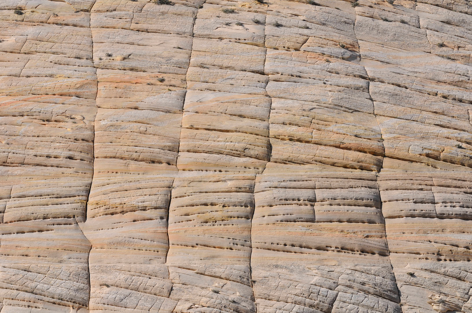
We woke up to 32 degrees but bright blue skies.  The forecast calls for snow today, Wednesday and Thursday morning but better weather returns for Friday through Sunday.  We will leave here on Monday to make the drive over to Moab's Dead Horse State Park.

This first photo was taken by Matt in his Monday sunset photo session at Sunset Point here in Bryce.


Matt left a little after 6am to do his sunrise shoot while I stayed warm under our down blanket.  He came back to the RV to pick me up about 8:30 and off we went to the Sunset point to start our hike down the Navajo Loop and into the Queen's loop.  It was just starting to spit snow as we left the RV.  Since it was just lightly snowing, we decided to put on our down jackets and start our hike.

We started on the rim of the canyon and hiked down to the floor following some very steep trails and lots of switchbacks.  It continued to snow all the way down the hike and we were only able to do one side of the Navajo Loop as the trail was experiencing some very large rock slides on the other side of the loop.  We finally reached the end of Navajo and were just starting to hike on the Queens trail when it began snowing harder and sticking to the ground a bit.  We decided we had better turn around and go back the way we came.  It was amazing, in 30 minutes, the once hard packed trail had become wet and muddy.  Near the top, the mud caked on our boots in about 2 inches under and all around.  It felt like we were walking with weights on our shoes.  We finally reached the parking lot and had to find some water puddles to get some of the mud off before we could even get in the truck to go home.

After a rest and warm up back at the RV, we decided to go exploring some more.  We left the RV about 4pm to pay a visit to the Visitors Center and Museum and to watch the introduction film there.  The video was informative, but the photography was not very good (although the lightening time lapse was pretty cool).  It was still cold and very windy so we decided to drive out to Bryce Point and Paria View.  We had packed a picnic dinner, but it was so cold and windy that we decided to have dinner at the Bryce Canyon Lodge.  It is a great old building built with the typical dark timber style and the wonderful old wavy glass panes.  It was a great dinner and I would highly recommend a visit there.

Here are a couple of photo's from Matt's sunrise shoot this morning.  This is what is called the Bryce Amphitheatre.  This photo was taken from the Bryce Point Overlook.  The Hoodoo's are amazing structures.

This second photo was taken of Thor's Hammer just after sunrise.  Thor's Hammer is located on the Navajo Loop trail just down from Sunset Point.

Monday, May 10, 2010

May 10, 2010 - Zion National Park to Bryce Canyon National Park (Utah)

Wow, I'm all caught up on blog posts.  Don't hold your breath cause I don't figure it will happen too regularly.

We made the 113 mile drive from Zion to Bryce Canyon National Park today.  We left Zion about 8:30 this morning to beat the majority of the traffic through the tunnel.  Again, we got the tunnel shut down so that we could drive right smack down the middle of it so both the RV and truck would clear it.

We did have our first skirmish between the truck and RV this morning as we left our campground.  Since we have a short bed truck, we have to have what is called a "slider" hitch that allows more sharp turns without the RV hitting the cab of the truck.  To leave the campground, we had it slide back and as we were pulling out of the campground onto the road, we heard this horrible noise as the trailer slide back some more.  We weren't quite sure what it was...  We stopped just before the park entrance to put the hitch back into normal mode and discovered a very nice hole through the tail gate of the truck and the tail gate jammed.  Matt got into the back of the truck and after kicking the tail gate multiple times, finally got it to open.  Well, as with everything else, the RV won!!  The truck now wears a duct tape bandage until we can get it fixed.

The rest of the drive was beautiful and the roads were in great shape.  We got to our campground, Ruby's Inn, just outside of the park entrance and our spot was ready for us even though we were early.  We finally got the thing level and then set off to explore the shuttle service for this park. 

Once inside the park, we rode the shuttle all the way down to the Overlook and then on the way back, got out at Sunset point and walked the mile back to Sunrise point.  A shuttle drive out of the park and we are now relaxing in the RV.

The weather here is quite chilly and windy.  Matt is planning on doing a sunset shot of the hoodoos and is going armed with his down jacket.  They are calling for snow to start here tonight and continue on into tomorrow with several inches possible.  Quite the difference from Zion even though they are so close.  Our elevation here is about 7700 feet.

May 9, 2010 - Zion National Park (Utah)

Sunday was our last full day at Zion.  Our original plan was to leave Zion on Tuesday and drive the 2 hours to Bryce National Park, however, they are calling for snow on Tuesday at Bryce so we decided that we will leave Zion a day early.

We spent this last day doing all the things we had not quite done yet.  We started out by driving the Zion-Mt. Carmel Highway from the South entrance of the park to the East entrance.  This was the same route that we came in towing the RV so this time was much easier and we didn't have to wait for the tunnel to be shut down for us (although we were required to fold in the truck's mirrors since the tunnel is so skinny). 

We went all the way out to the Checkerboard Mesa's.  I think you can see where they get their name in the photos below.

Our next stop was to do the Canyon Overlook Trail that is located just on the east side of the tunnel.  It was a beautiful 1 mile hike up to an overlook of the valley floor outside Zion Canyon.  Once we reached the top, we hung out to enjoy the beautiful views of the "Towers of the Virgin" across from us.  If you look closely, you can also see the road switchbacking multiple times down to the valley floor.  Yep, same road that we towed the RV into the park and same road we will tow it out of (thank goodness Matt is driving).


We decided to pay one more visit to Zion Canyon.  We parked the truck near the bottom of the canyon and hopped on the shuttle bus to the Grotto stop.  The Grotto stop is the original site of the visitors center, a very small rock building, but today it serves as a great picnic area.  Armed with our cooler, we had a great picnic under the beautiful trees and cliffs.

After our lunch, we exited the park to pay one more visit to the Visitors Center to pick up a few more postcards and then we went to buy our tickets to the Giant Screen Theatre to watch a film on Zion on an IMAX screen.  The film was OK as it seemed they wanted to keep you on the edge of your seat by flying through the canyons instead of showing the sites in detail.  I would not recommend it to anyone who gets motion sickness.  We also walked around a great photo gallery and the Museum of Photography located near the theatre. 

Since we are leaving here on Monday, we spent the evening doing laundry, picking up the RV and getting everything back in its "travel home".